

LOCATED ON THE BORDER OF ITALY AND FRANCE, MONT BLANC IS THE TALLEST MOUNTAIN IN WESTERN EUROPE AND THE TALLEST IN THE ALPS. IT'S HISTORY IS an essential part of THE VERY FABRIC OF MOUNTAINEERING HISTORY and central to the birth of alpinism.
Name: Mont Blanc
Height: 4810 m (15872 feet)
Location: France / Italy
First Climbed: 1786 (Michel Gabriel Paccard & Jacques Balmat)
Climb Time: 2 days
Best Time to Climb: June - September
Towering over the rest of the Alps at 4,810 meters Mont Blanc overlooks an the area that is a thriving hub of activity and popular destination for skiers, mountaineers, rock climbers and walkers alike. As the mountain is located between two countries, the mountain is referred to as Mont Blanc by the French and Monte Bianco by the Italians, with the meaning in both languages translating to White Mountain. The mountain gained its name because it is always covered with snow and glaciers throughout the year.
Even though Mont Blanc isn’t the highest mountain in the world, it is still a mountain that many climbers want to conquer. Although it is estimated that the height of the mountain is 4810 metres, it is difficult to provide an exact figure because the height of the snow cap may vary from year to year.
A Brief History
The mountain certainly has a long and interesting history. It is believed to have been first mentioned in history in 1626 when it was referred to as ‘The Accursed One’ because of its continuous glacial snow. The mountain is an impressive sight and can be seen as far away as Lyons. The first known tourists to Mont Blanc were Pocoke, Windham and friends, a group of Englishmen who visited in 1741. Their accounts of what they experienced sparked a huge amount of interest in the mountain and enthusiasm for Mont Blanc gained momentum.
In 1760, interest was heightened even further when Horace-Bénédict de Saussure, Swiss Geologist and Alpine Traveller, offered a very tempting financial reward for anyone who could reach the summit. In the years that passed many people attempted the challenge but failed, including de Saussure himself. That was until 1786.

Mont Blanc.
The First Ascent of Mont Blanc
On August the 08th 1786 at 4am, Michel Gabriel Paccard and Jacques Balmat left the Gîte à Balmat started their successful journey to the summit. But it was't easy. Balmat became very tired and looked as if he might quit. Somehow he didn't, perhaps because Paccard took on his pack and continued to urge him on, perhaps due to the weight of expectation of the observing crowds in Chamonix, that had trained their telescopes on the climbers. Whatever the reason the two (first Paccard, then Balmat) reached the top at 6:25pm, mildly frostbitten, dead-tired and almost blind from the snow. It has argued by many that this achievement marked the birth of mountaineering. Paccard a doctor from Chamonix and Balmat a hunter and crystal collector were admired for their achievement providing the inspiration for many climbers who have followed in their footsteps although as usual there was controversy as the likes of Marc-Theodore Bourrit, jealous of Paccar's success, put out communications suggesting they had not made the summit and Balmat had been the leader in an attempt to discredit the conquering hero.
Other notable ascents
The first female mountaineer to climb Mont Blanc was Marie Paradis (a maid-servant from Chamonix) in 1808 and after her own successful attempt she worked extremely hard in the years that followed to help other climbers who wanted to reach the summit as she once did. Paradis’ climb was certainly not easy and by the time she reached the top, it was said that she was in such a poor physical state that she had difficulty in speaking and could not see the view from the summit. Yet, Paradis was in every way a true mountaineer; with a self designed kit that weighed over 14 pounds she showed determination and resilience to reach the peak of Mont Blanc. Her account of the expedition was later recorded by Le Bland.
Notable Early Ascents
- 1786 - First ascent by Michel-Gabriel Paccard and Jacques Balmat.
- 1787 - First ascent by an Englishman, Mark Beaufoy together with 7 others.
- 1787 - Horace-Bénédict de Saussure ascend Mont Blanc.
- 1808 - First ascent by a woman, Maria Paradis.
- 1830 - Second ascent by a woman, Henriette d’Angeville.
Routes to the Summit of Mont Blanc
If you are considering the climb to the summit, it is certainly manageable for a fit mountain walker who can comfortably walk up hill for long periods of time. Over the course of the trail you will encounter a variety of tracks and walking conditions underfoot. Mountainous sections of the journey comprise of single track paths which can be rocky and uneven underfoot but the majority of the trail is forest roads, gravel or rough tracks. Above the snow line the ascent is more demanding, certain identifiable features are covered and there are the multiple dangers of the high mountains, not least of which are crevasses.
If you have no experience of this kind of alpine mountaineering you should; a) get some, b) use a guide.
Mont Blanc is surrounded by impressive glaciers, alpine surroundings and stunning scenery and it attracts thousands of mountaineers every year. What’s great is that to reach the top of Mont Blanc can be achievable not just for the seasoned climber but also for experienced winter walkers. However with elements such as altitude, crevasses, stonefall hazards and adverse weather some basic skills in mountaineering are important. But what exactly does the ascent to the top of Mont Blanc involve?
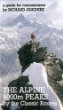

The bible for beginners and pros; easy to follow clear descriptions of the alpine 4000m peaks
The Gouter Route

Although it is often known as the ‘normal route’ the Gouter Route is not to be taken lightly. This route still requires high levels of fitness, sufficient acclimatisation to mountain walking and basic skills associated with climbing a mountain. The Gouter Route begins at the Tramway du Mont Blanc through up to Nid d’Aigle. This can be reached by tram from St Gervais or starting at Les Houches and taking the cable car so it’s really up to the climbing group which option you prefer. Once you reach Nid d’Aigle head south for approximately 50 meters on an expansive walking track before exiting left onto a smaller trail.
You can identify which path to venture onto using small highlighted areas marked with red paint. The early sections of the path will feature lots of sharp turns and winding paths as you navigate through before it straightens back out again, by which point you will have reached Baraque Forestiere des Rognes and you will find a small and unmanned hut. Once you leave this point, the trail you will find that the paths will become more open to the elements and the incline will become steeper as climbers progress up the ridge.
The views around this point are particularly impressive. There are various huts along the way including the Tete Rousse named after a glacier in the area and is two to two and a half hours from Nid d’Aigle. If you decide to stay at the Tete Rousse hut, you will find that it is not as busy as the other hut the Gouter. What's more, when you commence walking on the second day you can pass over the Grand Couloir walking in the more comfortable, cooler part of the day rather than having to navigate this section of the climb in hotter conditions found during the day. The only drawback to this is that it will add a further three hours of walking up hill to the summit. The Grand Couloir should be approached with care and the following top tips will come in handy;
- The area can be very busy, so its advised that you remain in a suitable place until there is a safe opportunity to pass without causing problems for others.
- Try to keep a steady pace as you move up to the Couloir but making sure that you stop regularly along the way to check for falling rocks or obstacles.
- When entering this phase of the climb it is recommended that you move relatively quickly and avoid staying in the area for longer than you have to.
- Browse a list of the best 4000m peak guidebooks, including Richard Goedeke's 4000m Peaks of the Alps which gives simple straightforward route guide
Once you have safely crossed the Couloir the next section of the route is still prone to stone falls so ensure that you keep moving for at least an additional 50 vertical meters. A rough path will lead climbers to the south facing aspect of the mountain before you get to Aiguille du Gouter. Keep to the path and follow the periodic patches of red paint located along the trail to keep you on the right track. This section of the ascent does require a certain degree of scrambling but this is relatively easy until you reach 3600m.
At this point, cables have been added to the trail for climbers to aid climbing and they do offer some additional support as you navigate the slope. Follow these rails until you arrive at the now abandoned Gouter hut. Climb a small, snow covered slope to the right of the Gouter hut using the cable handrails provided to safely reach the top of the Aiguille du Gouter. Take a breath and marvel at the spectacular views of the route you have just walked. Continue on your journey for a further 100 meters across relatively flat snow covered terrain before you get to the new Gouter hut which is located around three hours from the Tete Rousse.
If you intend on staying overnight at the Gouter hut, walkers can enjoy an early morning breakfast, but the specific time will depend on the time of sunrise. The ascent to the Dome du Gouter is frequently climbed in hours of darkness but luckily the climb is relatively straightforward. After navigating two small inclines on the eastern sides shortly after embarking on the next step of the journey, the route will progress up the Dome du Gouter on the North Western side. This section of the climb presents very few problems other than an occasional crevasse to be aware of. Once you have passed under the Dome du Gouter, you will begin a gradual descent to Col des Domes which is at the base of the Bosses ridge and is approximately two and a half to three hours away from your last stop in the Gouter hut.
From this point, you will navigate your way through a 100 meter, snowy incline until you reach another hut called Vallot. This hut was set up as a place of safety but a number of mountaineers use it as a place to camp out overnight. It isn’t the best places to stop with a lot of waste piled up and conditions being far from ideal but it does serve as a warm place to shelter from the harsh conditions overnight. A further steep climb leads to two prominent hills which identify the start of Bosses Ridge. Travel over the Grande Bosse and Petite Bosse and navigate up the exposed snow ridge until you reach the summit, making sure that you stay to the west. This point in the climb will be approximately five to six hours from the hut at Gouter.
The Trois Monts
Perhaps one of the more challenging and certainly more dangerous routes, this should only be attempted by the experienced climber and those who are knowledgeable in mountaineering. Although it is dangerous, the Trois Monts route does have several distinct advantages. Perhaps one of the main benefits is that the Cosmiques hut is only a very short distance from the cable car at Aiguille du Midi. With the Gouter Route, you have to embark on an intensive five hour trek before you reach the Gouter hut. Although this walk provides an easier start, it is prone to the occasional fatal accident and walkers have to be aware of serac fall along the route.
Once you have left the starting point at Aiguille du Midi, climb down the renowned snow covered steep mountain ridge before heading back west to reach the Cosmiques hut. It takes approximately 40 minutes to reach the hut. Climbers will enjoy a breakfast served early allowing you plenty of time to complete the next phase of the ascent. This stage of the climb will take in the plateau at Col du Midi as well as the Mont Blanc du Tacul.
This route does vary each year and even more frequently than this, with changes to the route being made on a monthly basis to accommodate the ever changing conditions and terrain. It is therefore important to be aware that there may be some slight deviations from a route that you have been provided with by a guide. The trail usually runs from the lower area of the mountain before the route ascends to the north west of Mont Blanc du Tacul. This stage takes approximately two to three hours from the Cosmiques hut. In late climbing season, there are several difficult areas to navigate in the climb including crevasses often located underneath the shoulder although local guides often leave ladders to facilitate the crossing. Once you have carefully navigated across the shoulder, you can proceed on to reach the northern side of Mont Maduit which descends slightly before you begin the final ascent to the summit. The trail that you take will often depend on the weather conditions. Very close to the Col du Mont Maudit climbers will encounter what is known as the crux step. This is a particularly challenging phase of the climb due to the amount of snow in the area.
Anchors and cables have been installed throughout this phase to make it a little easier for climbers to navigate. Following on from this step in the climb, you will progress to the Col de la Brenva. Depending on what time you set off, by the time you reach this point in the climb it should be around Dawn and you will now be entering into some of the more impressive stages of the route. By now you should be approximately five to six hours away from the hut at Cosmique.
It is always useful to note that the journey from Col de la Brenva to the highest point of the mountain is perhaps further than it may appear and perhaps not as pleasant as the Bosses Ridge climb, but the surroundings and views are absolutely stunning. The summit of Mont Blanc will appear suddenly and takes approximately seven to eight hours walk from the hut located at Cosmiques.
Tour du Mont Blanc (TMB)

A hugely popular long distance walk, the Tour du Mont Blanc is a great alternative to climbing Mont Blanc, giving spectacular views of this epic mountain and taking in France, Italy and Switzerland. At around 170 km the TMB is one of the classic long distance walk in Europe. There are a number of 'variant' routes but essentially during the trek you can stay in various mountain huts along the route which are purpose built for walkers, accommodating between 20 and 120 of fellow outdoor enthusiasts. On offer in these huts is a bed and, for those who want it, an evening meal and breakfast with packed lunches also available to order depending on whether you use a trekking company to guide you.
The tour is something that is certainly an achievable task without guides with excellent maps, guidebooks as well as a well marked path, for those with a decent amount of hill-walking / thru-hiking experience. Although challenging the TMB route is more of a picturesque holiday than a tough course to complete, hence its popularity.
However, as always you should not underestimate how physically demanding the walk is. Typically it takes 11 days and every day you will have to walk between six and eight hours so it is recommended that you pack reasonably light, take adequate clothing including waterproofs and go equipped with supplies such as a packed lunch and sufficient water.
As we mentioned the Tour du Mont Blanc is a circular route completed in 11 steps starting at Les Houches, Refuge du Truc, La Balme, Col de Checroui, Courmayeur, Refugio Bertone, Rifugio Elena, Champed, Le Peuty, Treble-Champ and Refuge Flegere.
If this all sounds too easy you might want to try the UTMB; the Ultra Trail du Mont Blanc, an ultra marathon which follows the course of the TMB.
Descending Mont Blanc
As a final note it is worth mentioning that many climbers are so focused on getting to the top of a mountain that they often fail to contemplate the descent properly. Once you reach the summit you are only halfway there, you have to safely navigate your way back to civilisation. Both of the routes above can be followed in reverse allowing you to safely get back home. The full descent time on the Trois Monts route takes approximately four to five hours whereas the Gouter trail takes about the same time to reach Nid d’Agille.
As with any mountaineering venture it is crucial that you take the right kit, dress appropriately and prepare for every eventuality. For those inexperienced in mountaineering, it may be advantageous to learn some mountaineering skills in detail and take along a guide who can help you through the trickier aspects of the climb and descent. Its worth it, the sense of achievement that you will receive after reaching the summit will be one that you will remember for many years to come.