

Mount Fuji seems a geographical reflection of Japanese culture more generally: ordered, pristine, effortless. The ordered trails reinforce this further. And yet its violent past, and probable future, sits in stark contrast to the peace it has become synonymous with.
Name: Mount Fuji
Other names: Fujisan (Japanese)
Height: 3,776 m (12,388 ft)
Location: On Honshu Island, Japan.
First Climbed: Around 663 AD by an unnamed monk or Fujiko.
Climb Time: 6-21 hours.
Best Time to Climb: July-September (official season)
INTRODUCTION TO MOUNT FUJI
Few mountains are as instantly recognisable as Mount Fuji (3,776 m/ 12,338 ft). With its gently curved, snow-covered slopes rising above blooming cherry blossoms in countless paintings, this mountain promises a serene ascent to the top of Japan.
With a clear spiritual heritage like few other peaks, this sacred mountain has become the most visited summit in the world in the modern age.
Jump to Climbing or Trekking Guide
So, close your eyes and conjure a picture of the mountain, seen so often in the late spring as the cherry blossoms burst into colour and the snow reflects the waking sun.
Let’s meet Mount Fuji.
HISTORY OF MOUNT FUJI
Fujisan, or Fuji-san, simply means ‘Fuji mountain’. The name Fuji has disputed roots, with two claims the most creditable.
A root in the indigenous Ainu language, would cause Fuji to mean ‘everlasting life’. Alternatively, if the root is the Yamato language, then it would refer to Fuchi, a Buddhist goddess of fire.
Another nickname, Konohanasakuya-hime, meaning ‘causing the blossom to brightly bloom’ no doubt refers to the mountain’s ubiquitous spring appearance, framed by the pink cherry blossoms.
As a symbol of Japan, peaceful nature and a UNESCO World Heritage site, it is a cherished peak in Japanese culture. It is also revered in numerous spiritual practices, including Shugendō practitioners, who reside on this, and other mountains.
It is unclear exactly when the reverence of the peak began, but likely pre-dates the building of the first shrine, 1,900 years ago. Mount Fuji’s ultra-prominence, so different to the consistent rocky ranges found around the rest of Japan, must have made it a uniquely striking feature of this landscape as it rose over the last ten thousand years.
Shintoists consider the mountain a sacred site of Sengen-Sama, a goddess of nature, reflected by the shrine to her at the summit. The Fujiko sect (pilgrims) believe the mountain is a being with a soul of its own. Japanese Buddhists believe it is simply a gateway to another world.
Mount Fuji is one of Japan’s three Holy Mountains. The other two are Mount Tate (3,015 m/ 9,892 ft) in the Hida Mountains and Mount Haku (2,702 m/ 8,865 ft) in the Ryōhaku Mountains.
Mount Fuji is also (arguably) the world’s most climbed peak. Estimates place the number of annual ascents between 100,000-300,000, and almost all do so within the short summer season. Two thirds of the mountain’s hikers are Japanese, reflecting perhaps the reverence it holds for its own culture.
GEOGRAPHY OF MOUNT FUJI
This mountain’s formation is revealed in its gentle domed shape, built by the pyroclastic flows that have slowly built up its slopes over the course of many eruptions. Mount Fuji is still considered an active stratovolcano, with the last major eruption occurring in 1707-1708.
It is located at the meeting point of three minor plates: the Amurian, Okhotsk and Philippine Sea Plates. The current circumference, formed by the many lava flows, is125.5 km (78 miles) and the crater at the summit is 250 m (820 ft) deep.
It formed in place of two older volcanoes, Komitake and Ko-Fuji, which were active until 10,000 years ago. Mount Fuji first became active at this time, and deposited sufficient basalt rock over these old volcanoes to essentially bury them. Mount Fuji’s main eruption and building period was 3,000-4,500 years ago.
There are over 100 small volcano cones on Mount Fuji, mostly now inactive. The main volcano cone at the summit is still active, with recent warnings of activity and pressure build-up to levels that could signal an eruption soon.
On clear days, Mount Fuji can be seen from both Tokyo and Yokohama to the east, and on the bullet train journey between Tokyo and Osaka. A clear day is something of rarity though, especially in the summer, so you may see only a headless peak rising into clouds.
The mountain stands almost entirely by itself, as if it had cleared the area foritself. It overlooks Suruga Bay in the south of Japan, with only the diminutive Mount Ashitaka (1,457 m/ 4,780 ft) to the south of it.
Encircling the mountain on all other sides are numerous ranges, including the Japanese Alps (three ranges to Mount Fuji’s west and north). Japan’s capital, Tokyo, lies 100 km (62 miles) to the mountain’s north-east.
In total, Japan has 21 mountains above 3,000 m (9,843 ft), 20 of which are below 3,200 m (10,499 ft). The second highest, Mount Kita (3,193 m/ 10,476 ft), is 583 m (1,912 ft) smaller than Mount Fuji.
WILDLIFE OF MOUNT FUJI
Flora.
One of the most famous flora to be associated with any mountain is Mount Fuji’s Sakura, the pink cheery blossoms that frame so many paintings and photos of the famous peak. Their blooming marks a public holiday in Japan, celebrated across the country. The best place to view them is around the Fuji Five Lakes.
The lower forests of the mountainous zone are rich in flora, including species of beeches, maples and bamboo grasses. More local flora include the Japanese cedar, Hinoki cypress, Mizunara and Nikko fir.
In the subalpine zone, from 1,600-2,500 m (5,250-8,200 ft), North Japanese hemlock and Veitch fir lead into gold birch and Japanese larch, which continue to the treeline in the alpine zone. Above this, only moss and lichens survive below zero temperatures and regular snow cover.
Fauna.
There are 37 listed mammals and over 100 species of bird found around Mount Fuji. Asiatic black bears may be spotted, though a Japanese squirrel or fox is a more likely bet.
The Japanese serow, native to Japan is very hard to spot in its forest habitat. This slow-moving antelope-goat, known locally as the Kamoshika, is a mountain-dwelling creature with grey fur. Eating a low-nutrient vegetarian diet, spending a lot of its time chewing the cud while roaming secretively through the forests.
The highest dwelling birds are the Iwahibari (alpine accentor) and Hoshigarasu (nutcracker), found above 2,500 m (8,200 ft). Several species of warblers and flycatchers can be found lower down, as well as two types of asian owls (ural and scops owls).
One of the more extraordinary birds is the Japanese paradise flycatcher. Its bright blue beak and eyes sit atop a slender black body and a tail that is around twice the length of its body.
FIRST ASCENT OF MOUNT FUJI
As a sacred mountain in various Japanese religious and spiritual traditions, Mount Fuji has been climbed as a form of pilgrimage for hundreds, if not thousands, of years. Some accounts cite an unnamed monk as the first ascent in 663 AD, though there may have been other ascents before this.
The original pilgrim route, known as the Yoshida trail, begins at the Fuji Sengen Shrine, or Sengenjinja. The shrine, a World Heritage Site, is found the town of Fujiyoshida to the north-east.
The pilgrims who climbed from the shrine to the summit were known as Fujiko. Before their climb, they would purify themselves and pay their respects to Princess Konohanasakuya, the protector of Mount Fuji and a Shinto goddess, who is believed to be enshrined here.
The mountain was kept a sacred site for a much of its human history. Women were only granted permision to climb in the Meiji era of the late 19th Century; a reflection of archaic gender definitions in early adventure and religion alike.
Also around this time, the mountain was opened to westerners. The first westerner to climb the mountain was Sir Rutherford Alcock in September 1860, followed seven years later by the first western woman, Lady Fanny Parkes.

Mount Fuji by Hokusai
CLIMBING GUIDE FOR MOUNT FUJI
As one of the world’s most climbed mountains, picking the right time to climb is important to avoid something of the urban experience of queueing on the mountain. The busiest period is during Oblon week in mid-August, a Buddhist festival of ancestral remembrance and a major national holiday.
The quietest periods in the peak season is early July. Alternativel,y climb during one of the shoulder seasons, though be prepared for much colder conditions. Climbing in winter is discouraged, as extreme weather, snow, ice and avalanches become present dangers. However, if you have sufficient experience of winter climbing, it can be a pretty spectacular time to climb the mountain, as you’ll be almost completely alone.
None of the climbs on Mount Fuji pose any technical challenge, with wide, well-cut paths on all trails and a steady incline for much of the route. Afternoon storms are common in the summer, so early morning ascents are recommended.
There are four main trails (and one alternative start) to the summit, with start points in the north, east and south. Most trailheads are found at the ‘5th stations’, mountain stations where the road system stops. Names of these can vary between accounts, so check with the station you are on your intended route before heading out and stick to the relevant path as several criss-cross and lead you in the wrong direction.
Another terminology that can be potentially confusing for westerners, these ‘stations’ are on ‘lines’, which is the word used to refer to both roads (most have tolls) and trails. Note that no trains feed the immediate area around the mountain.
Most of the wide, easy-to-follow trails have several huts en route, breaking up the rocky uphill walk and selling snacks at prices that rise with elevation. The uphill and downhill trails are kept separate on all but the Fujinomiya trail in order to keep the traffic flowing.
At the top of the trails, you’ll find a couple of shrines. Here you can collect the last of your yashin, branded stamps burned onto a wooden walking stick, that can be purchased at the start of the trip. Alternatively, you can send a postcard from the mail station at the top—however you wish to mark your ascent of Japan’s highest mountain!
Yoshida trail
The most popular trail approaches the summit from the north. As the sunrise occurs on this side of the mountain, an early morning ascent is most popular.
This trail typically begins at the 5th station of the Fuji Subaru line (2,305 m/ 7,562 ft) and takes 8-13 hours to complete. The trailhead is in the Yamanashi Prefecture.
The full route, which was the traditional pilgrimage, begins at the Sengen Shrine (850 m / 2,789 ft) near Lake Yamanaka and adds an extra five hours to the journey. This may make more sense to split it into a two-day hike.
Kawaguchiko trail
Not listed as a separate trail as it joins the Yoshida trail early one, this route begins at one of the other Fuji Five Lakes.
Meaning ‘Lake Kawaguchi’, the trailhead is, predictably, at the Kawaguchi 5th station. It begins circling around the peak clockwise, losing some height, before cutting back south to join the Yoshida trail at the 6th station (2,390 m/ 7,841 ft).
Subashiri trail
Subashiri 5th station (1,950 m/ 6,398 ft), east of the mountain in the Shizuoka Prefecture, is less developed than some of the others, so arrive with all you’ll need for the hike.
It is reached by shuttle buses only during the peak season, as the road in is narrow and windy. Outside of the peak season it is normally closed.
This trail is quieter and less populated than the others, for the first sections at least. Beginning below the treeline, the route starts through forest before joining the Yoshida trail at the 8th station (3,100 m/ 10,171 ft) and turning south to gain the summit. Allow 8-13 hours to complete.
Gotemba trail
Gotemba 5th station (1,400 m/ 4,593 ft) is by far the lowest station, adding 900 m (2,953 ft) of ascent to the Yoshida trail, and making it the longest trail. It is a 10-16 hour return. It is also arguably a less interesting route, with lava rock the only feature in the uninspiring terrain.
However, the descent can be quite exciting as it is often taken at a gallop. One section, Osunabashiri or ‘the great sand run’, is a wide, even trail covered in loose gravel that people run down, covering distance with great strides very quickly. After a gruelling 7-10 hour uphill, this must come as some relief!
Fujinomiya trail
Fujinomiya 5th station (2,400 m/ 7,874 ft) is the highest of the trailheads and shortest hike. It is the second most popular and the 5th station is well developed to cater to visitors, who arrive by shuttle bus during the peak season. The route takes around 6-11 hours to complete.
Be aware that the trail’s approach from the south side of the mountain makes the sunrise only visible from the summit. It can also become congested, as the ascent and descent take the same trail, unlike the three other trails on the mountain.
INFORMATION ON TREKKING AROUND MOUNT FUJI
In the off-season, when the summit treks are not accessible, the Ochudo trail offers an experience the mountain. Traditionally, this circuit of the mountain was only for those who had climbed the mountain at least three times, but now it is open to all.
Originally, this path circled Mount Fuji around halfway up its slopes (between 5th and 6th stations) and ran for around 20 km (12.5 miles). It holds a religious significance to Shugendō ascetics, a syncretic, mountain-dwelling practice that prioritises the relationship of humans to nature.
Today, it can be accessed most easily from the 5th stations around the mountain, but is no longer a complete circuit. Several sections have been closed for safety reasons. However, enough of the route is open to warrant a visit to this gently undulating path around the mountain.
Kofuji (1,979 m / 6,493 ft) translates as ‘little Fuji’. This secondary peak of Mount Fuji can be climbed from Subashiri 5th station. It is a shorter, easier option to bag a mountain without taking on Mount Fuji itself, with an ascent that takes only 20 minutes!
Equally, the summit of Hoeizan (2,693 m/ 9,491 ft) offers unobstructed views of the Pacific Ocean to the south and east. It was formed during Mount Fuji’s last eruption in the early 18th Century and is situated on the mountain’s south-eastern slopes. It is most easily accessed via the Fujinomiya trail.
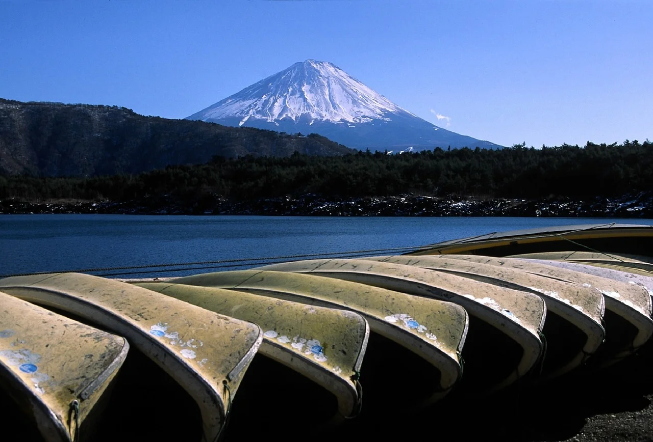
For those not looking to climb higher at all, a visit to the Fuji Five Lakes, known locally as Fuji-goko, is a must to experience views of the mountain and the famous local flora.
The lakes stretch east to west in a semi-circle to the north of Mount Fuji. These lakes are Lake Yamanaka, Lake Kawaguchi (both trailheads for summit hikes), Lake Sai, Lake Shoji and Lake Motosu. The western shores of Lake Sai has an unfortunate claim-to-fame: it is known as Japan’s top suicide spot.
The lakes can be toured on a local bus, or if you feel up for a challenge, by bicycle. Allow a full-day to experience the lakes and the attractions that are situated nearby