
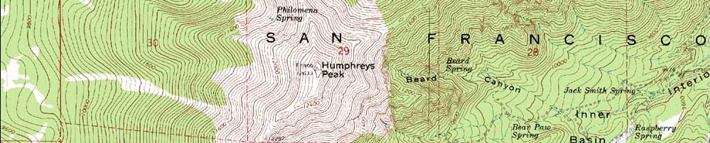
In Coconino County, Humphreys Peak stands as the high point of Arizona at 3,851 m (12,635 ft).
Better known for its canyons (home to the most famous canyon of all, the Grand Canyon), Arizona typically evokes images of deserts, orange and red earth and plains filled with cacti. As such this snow-capped mountain can boast only modest fame as an unexpected addition to this south-western state.
Located 17.7 km (11 miles) north of the town of Flagstaff, Humphreys Peak is actually part of the San Francisco Peaks. This group of extinct volcanoes make up one of 210 distinct mountain ranges found in Arizona.
But to make navigating, or learning, them simpler, Arizona’s mountains are normally referred to by the county in which they are found. Humphreys Peak is found in the mid-northern county of Coconino.
Using the 7.7 km (4.8-mile) Humphreys Summit trail, the mountain can be ascended with a simple hike through the Coconino National Forest. It’s also a popular ski resort, so summer hiking and winter skiiing are the most common activities on the mountain.
It also goes by the name San Francisco Peak, approved as an alternative in 1911.
Five highest peaks in Arizona:
• Humphreys Peak – 3,851 m (12,635 ft), the highest peak in the Coconino Range.
• Agassiz Peak – 3,766 m (12,356 ft), found in the Coconino Range.
• Fremont Peak – 3,648 m (11,969 ft), found in the Coconino Range.
• Doyle Peak – 3,493 m (11,460 ft), found in the Coconino Range.
• Mount Baldy – 3,480 m (11,417 ft), the highest peak in the Apache Range and not to be confused with Mount San Antonio in California.

LATEST BLOG POSTS
I quit the rat-race to live a more adventurous life. This is my journey.