
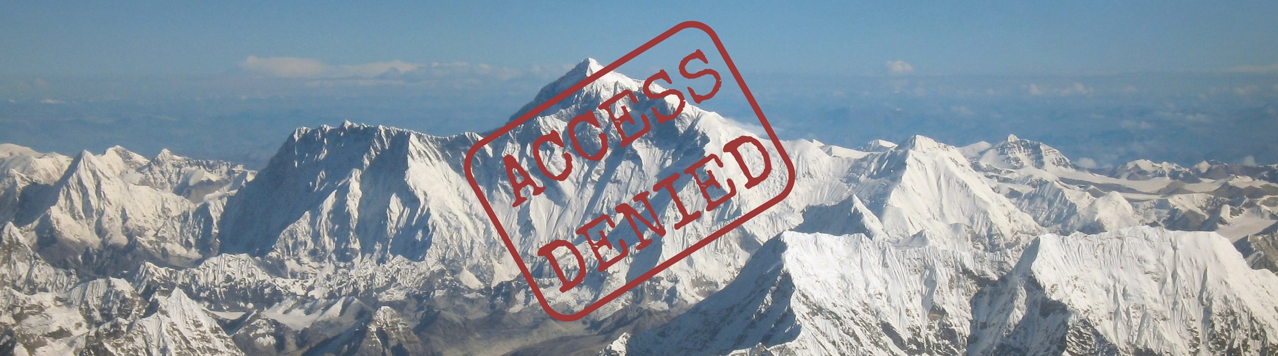
With the news that Mount Umunhum, a mountain whose summit has been closed for the last 59 years is about to hold an opening ceremony and allow hikers to reach the very top, from mid September 2017, we decided to take a look at some other mountains you are not likely to climb any time soon.
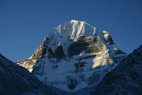
1. MOUNT KAILASH
Elevation: 6,638 m (21,778 ft)
Why it can’t be climbed?
It is considered a holy mountain, a sacred place for four religions: Buddhism, Hinduism, Japanism and Bön. Reinhold Messner was given the opportunity by the Chinese government to climb in the mid-1980s but he declined. Nobody has ever climbed this mountain.
Where is it?
Mount Kailash (Kailāsa (कैलास) in Sanskrit), also known as Kangrinboqê or Gang Rinpoche, is located in Kailash Range (Gangdisê Mountains), which forms part of the Transhimalaya in the Tibetan Autonomous Region of China.
Tell me more:
Herbert Tichy, an Austrian mountaineer who explored the area in 1936, asked one of the Garpons of Ngari (regional leader) if Kailash is even climbable, and he answered: “Only a man entirely free of sin could climb Kailash. And he wouldn't have to actually scale the sheer walls of ice to do it – he'd just turn himself into a bird and fly to the summit.” I think that's a No.
Even though you can’t climb it, you can take a sacred pilgrimage to Mount Kailash – pilgrims of several religions believe if you walk around Kailash 108 times, you would reach the state of ultimate meditation. The hike should be made in one day, but is not considered an easy task: it takes an approximate of 15 hours to complete it. It’s 52km long, starts at 4600m (15,000ft) and includes an 5600m (18,372ft) pass.
“The idea of going on a trek or a mountaineering feat is always toward a sense of achievement, to make yourself bigger than who you are. But the idea of a pilgrimage is to subdue yourself.”
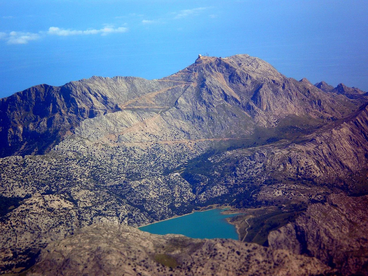
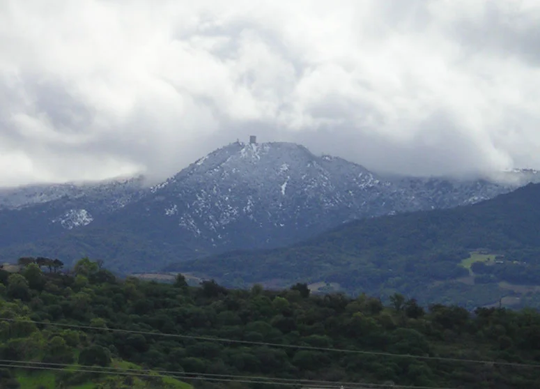
2. PUIG MAJOR
Elevation: 1,445 m (4,741 ft)
Why it can’t be climbed?
It is located in a military zone.
Where is it?
It’s the highest peak on the Spanish island of Mallorca, located in the Serra de Tramuntana Mountains.
Tell me more:
You can actually climb some part of this mountain, up to 850m where the military zone begins.
The neighboring peak called Puig de Massanella (1364m (4475ft), is the highest climbable peak on Mallorca.
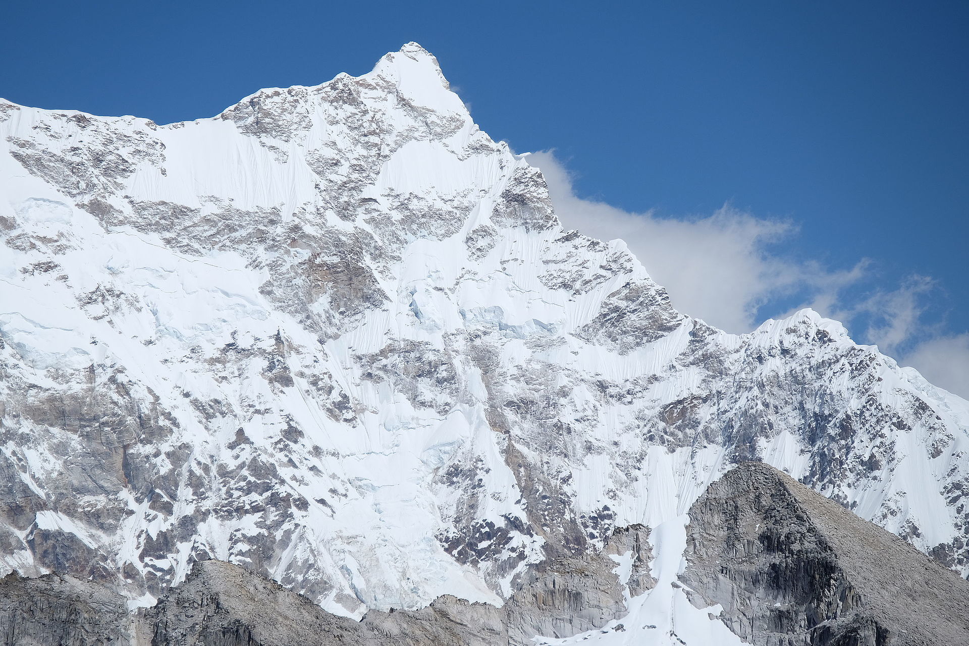
3. GANGKHAR PUENSUM
Elevation: 7,570 m (24,840 ft)
Why it can’t be climbed?
Bhutan didn’t allow mountaineering up until 1983, because they believe that the mountains are the dwelling of spirits. Between 1985 and 1986, four expeditions were made, but none succeeded in summiting the peak. In 1994, the government again forbade climbing the mountains higher than 6000m and in 2004 mountaineering in Bhutan was completely banned.
Where is it?
Gangkhar Puensum is the highest mountain in Bhutan, and highest unclimbed mountain. It’s a part of the Himalayan mountain range, on the border with China, but there are still disputes about its exact location.
Tell me more:
Its elevation was first measured in 1922, but until recently, the maps of this whole region were very inaccurate. According to the British 1986 expedition, the mountain was located entirely in Bhutan. In 1998, a Japanese expedition gained permission to climb the mountain from the Chinese Mountaineering Association, but it was withdrawn because of the political issue with Bhutan. After that, in 1999, they climbed the neighboring peak Liankang Kangri (Gangkhar Puensum North). This expedition’s report shows that the Tibet-Bhutan border crosses the summit of Gangkhar Puensum.
4. MOUNT YAMANTAU
Elevation: 1,640 m (5,380 ft)
Why it can’t be climbed?
Mount Yamantau means "evil mountain" or "bad mountain" in Bakshir language. Local inhabitants were afraid of climbing it, dreading the evil spirits that haunt in the mist. They also believed that a huge poisonous snake that could turn into a thundercloud lived at the top of the mountain. It is an ominous rocky mountain, full of hollows, and is often shrouded in fog.
The more rational reason you would might not want to climb this mountain is that US believes that there is a large Soviet nuclear facility buried deep in the mountain.
Where is it?
It’s the highest mountain in the southern Urals, located in the Republic of Bashkortostan, Russia.
Tell me more:
US observed large excavation projects on the mountain by the satellite in the late 1990s. They repeatedly questioned Russian government about it, and got several different responses. They said it’s a mining site, a repository for Russian treasures, a food storage area and a nuclear war bunker.
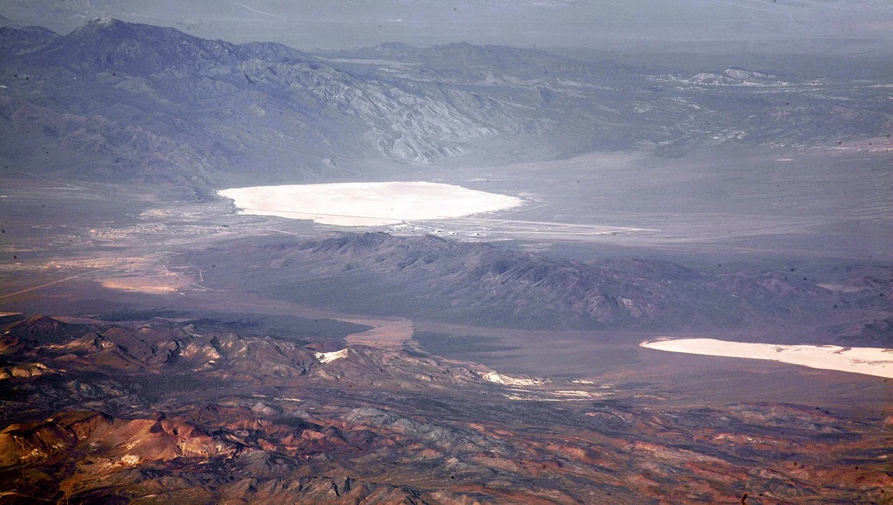
5. GROOM MOUNTAIN RANGE
Elevation: 2,819 m (9,249 ft)
Why it can’t be climbed?
US Air Force closed public access to Groom Mountain because it overlooks the Nevada Test and Training Range, commonly known as Area 51. It’s illegal to climb it, or even come near it. Signage around the base perimeter advises that deadly force is authorized against trespassers.
Where is it?
It’s a mountain range in Lincoln County, Nevada, USA.
Tell me more:
You’ve probably heard about Area 51. The base’s current primary purpose is still unknown, but it’s probably a place for development and testing of experimental aircrafts and weapon systems. And UFOs, of course.
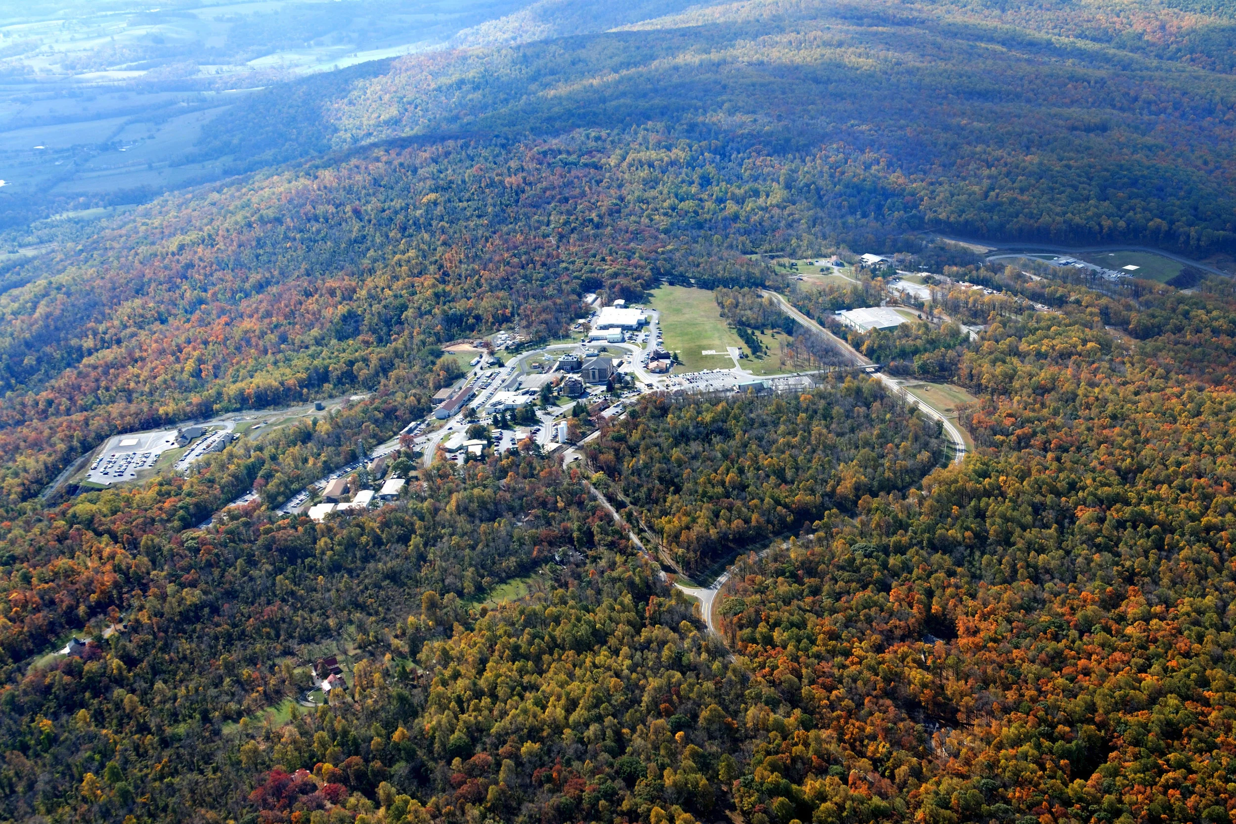
6. MOUNT WEATHER
Elevation: 524 m (1720 ft)
Why it can’t be climbed?
“Mystery Mountain” is home to a top-security underground installation close to Washington DC.
Where is it?
It’s located in the Blue Ridge Mountains, in Bluemont, Virginia, US. It is also barley a mountain, in truth.
Tell me more:
The Mount Weather Special Facility is an unacknowledged Continuity of Government (COG) facility operated by the Federal Emergency Management Agency (FEMA). This facility also houses FEMA's National Emergency Coordinating Center and a dozen buildings providing communication links to the White House Situation Room. The underground bunker includes a hospital, crematorium, dining and recreation areas, sleeping quarters, reservoirs of drinking and cooling water, an emergency power plant, and a radio and television studio which is part of the Emergency Broadcasting System. It also has its own leaders, police, fire department - and laws. It was originally built to house governmental officials in the event of a full-scale nuclear exchange. According to the Washington Post, most of the US government officials were evacuated to the Mount Weather after the 9/11 attacks.
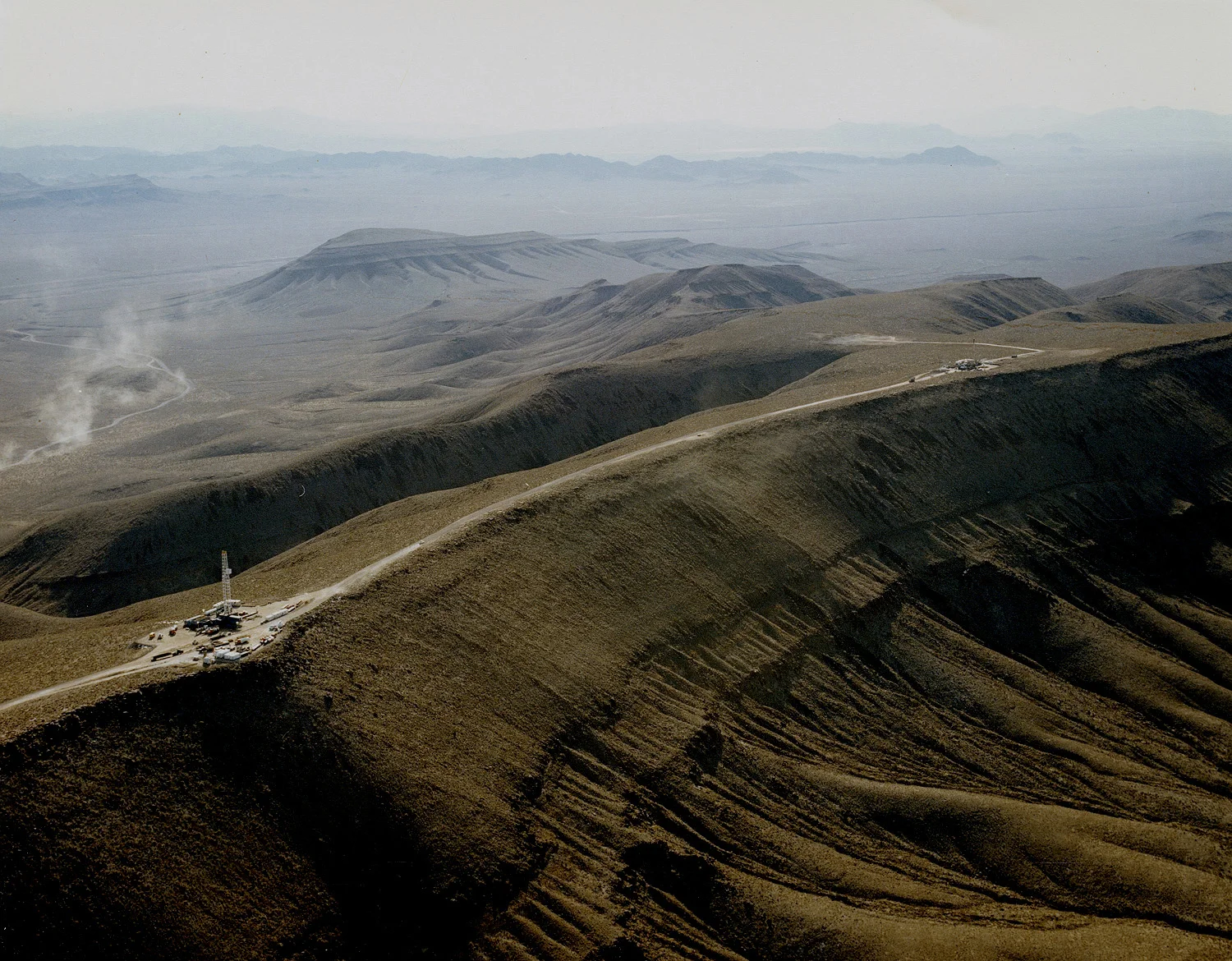
7. YUCCA MOUNTAIN
Elevation: 2,044 m (6706 ft)
Why it can’t be climbed?
In 1987, Yucca Mountain was designated by the Nuclear Waste Policy Act to be a repository storage facility for spent nuclear fuel and other high level radioactive waste.
Where is it?
It’s located in the Nye County, Nevada, US. It’s part of the federal land adjacent to the Nevada Test Site.
Tell me more:
It’s said to be the most studied real estate in the world. After thorough consideration and experiments, in 1986 Yucca Mountain was the highest ranked of 5 nominated sites, based on its geology, tectonics, meteorology, costs and socioeconomic impact. They built 7 miles of underground tunnels through the mountain in the next 20 years, to conduct various experiments and studies. In 2002 the project was further approved by the US Congress, but in 2011 the funding for the site ended under the Obama Administration. The Yucca Mountain site has been abandoned, marked by the fenced-off entrance to the tunnels. Unfortunately, in March 2017, Trump administration restarted an approval process for the site.
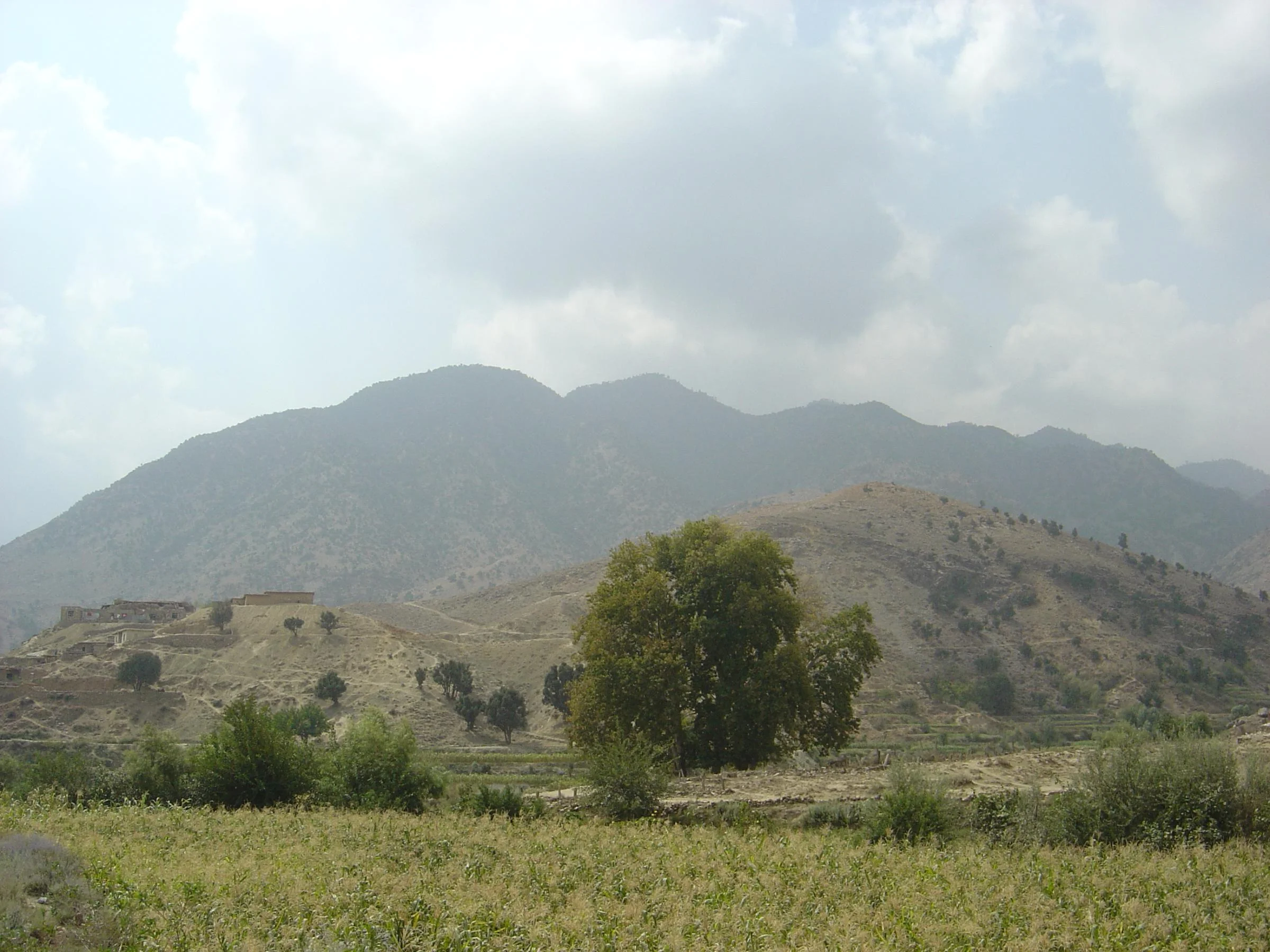
8. TORA BORA MOUNTAIN
Why it can’t be climbed?
The cave complex in the mountain was the stronghold of the late Al-Qaida chief Osama bin Laden. In June 2017, there was a battle between the Taliban and ISIS, and after ISIS initially succeeded in capturing the surrounding region from the Taliban, Afghan government forces retook the cave on 17 June.
Where is it?
Tora Bora (Black Cave), known locally as Spīn Ghar (White Mountain) is part of the White Mountains in eastern Nangarhar province, Afghanistan.
Tell me more:
During the US Invasion of Afghanistan, this cave complex was one of the strongholds of the Taliban and Al-Qaeda. It was described as an “impregnable cave fortress” with a complete city built in it – it supposedly housed a hospital, hydroelectric power plant, a hotel, arms and ammunitions store, huge roads, and sophisticated ventilation systems. But, in an interview, US Special Forces Sergeant said that the caves weren’t that big and mostly natural, and that there were only small bunkers and a lot of ammo storage.
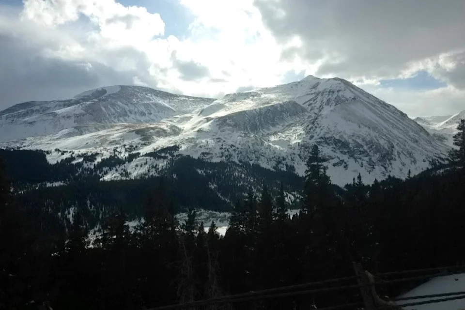
9. MOUNT BROSS
Elevation: 4,321 m (14,178 ft)
Why it can’t be climbed?
In 2005, the summit was closed to the public access by the landowners. You can still hike around the mountain, and reach the current legal summit that is only a foot shorter than the actual summit.
Where is it?
It’s located in the Mosquito Range of the Rocky Mountains. It is one of the Colorado 14ers, located in the Pike National Forest.
Tell me more:
For years now, the US Forest Service, Colorado Fourteeners Initiative and the landowners are trying to figure out a plan for the access to the summit. It is still illegal to climb the actual summit, but you can get very close. There are six routes to the legal summit, and the Standard Route is usually combined with ascents of Mount Cameron and Mount Lincoln, and sometimes Mount Democrat.
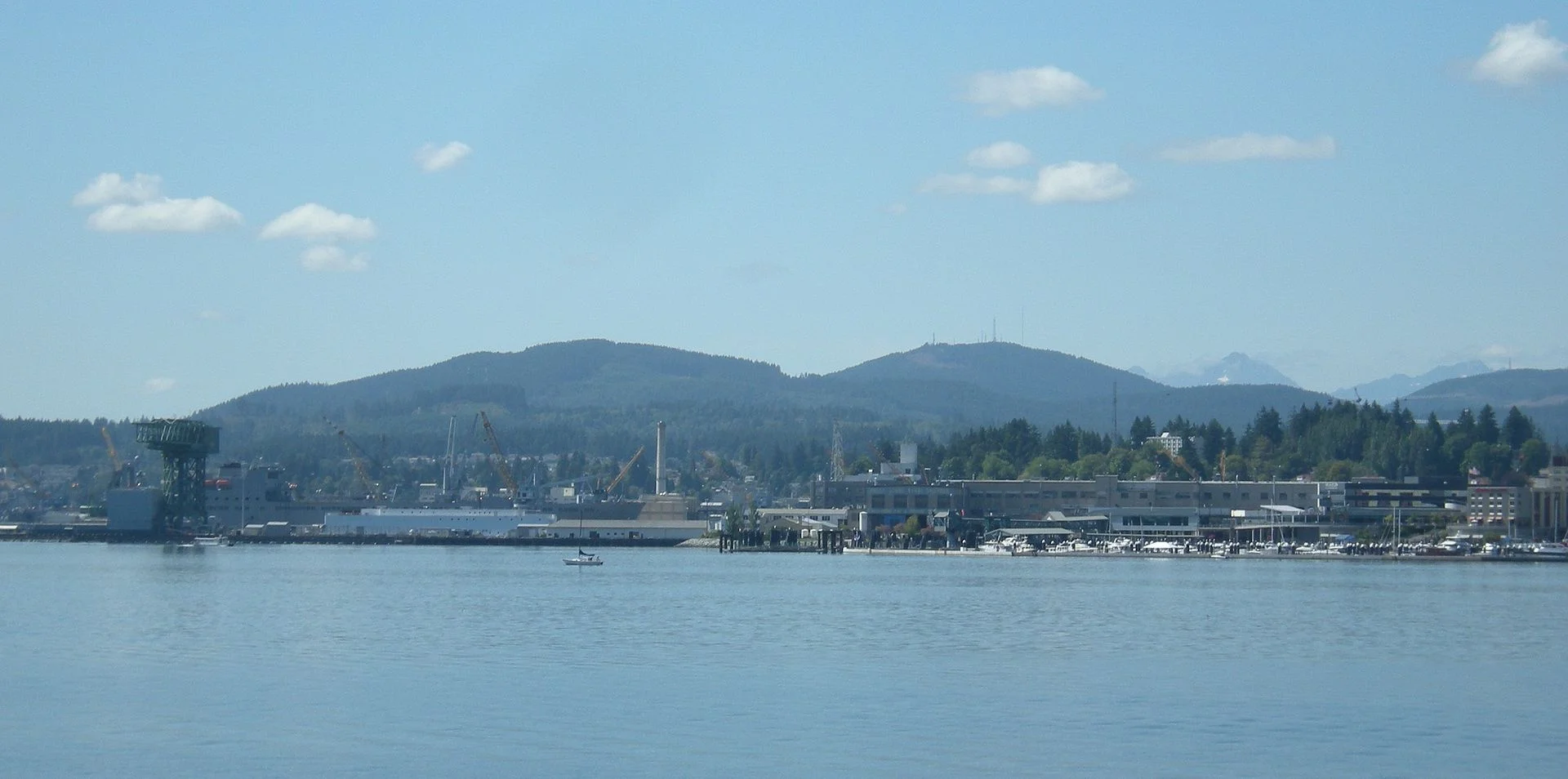
10. GOLD MOUNTAIN
Elevation: 537m (1761 ft)
Why it can’t be climbed?
The route to the summit goes through the Bremerton Watershed boundaries in several sections, and no public access is allowed because no filtration plant is being used for the watershed area. The Bremerton Watershed is frequently patrolled by authorities, and arrests and prosecutions are very likely for anyone caught on the watershed land.
Where is it?
It’s located in the Kitsap County, Washington State, US.
Tell me more:
Even though it’s illegal to hike to the summit, many hikers and bikers still do it. Historically, no one has ever been arrested or harassed by the officials if they stayed on the main marked roads. However, on the paper, it is still illegal and considered unsafe to hike here, so any people attempting to summit this peak do so at their own risk.
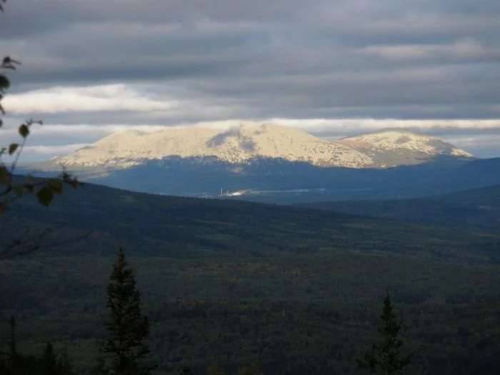
MOUNT UMUNHUM*
Elevation: 1,063 m (3,489 ft)
Why it can’t be climbed?
The route to the summit will finally be opened on September 16-17. It was closed to the public since 1980 due to hazardous materials and unsafe, partially demolished structures from the former Air Force station.
Where is it?
It’s located in the Santa Cruz Mountains, California, US.
Tell me more:
Mount Umunhum means resting place of the hummingbird in Ohlone language (it's not named after a Muppets song). It offered a place of prayer for Native Americans.
The District received funding to restore the peak for public access in 2009. The road and trails are improved and parking areas and weather shelters have been built. “The cube”, a five story concrete radar tower that has been a recognizable feature of this mountain will be preserved and repaired.
But Do not despair at the thought of not being able to reach a summit!
Here is a list of the 4 highest unclimbed mountains that can be legally climbed, but all the expeditions until now have failed:
- Muchu Chhish – 7,543 m (24,747 ft), Pakistan
- Kubru North Summit – 7,394 m (24,259 ft), Nepal
- Labuche Kang III – 7,250 m (23,786 ft), Tibet
- Karjiang – 7,221 m (23,691 ft), Tibet
Off you go!

LATEST BLOG POSTS
I quit the rat-race to live a more adventurous life. This is my journey.