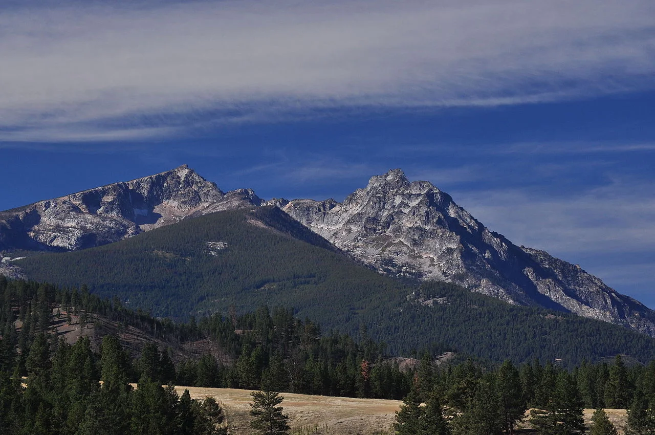
The spectacular Bitterroot Range was named after Montana’s state flower – Bitterroot, a small pink flower that blooms in July colouring its slopes in pink.
Name: Bitterroot Range
Height: Peaks’ average height - 2,700 m (9,000 ft), the highest point - Scott Peak 3473m (11,394 ft).
Location: Montana - Idaho border, USA
First Climbed: 1804-05 by Lewis and Clark
Climb Time: 5+ hrs (depends on the trail)
Best Time to Climb: Spring, summer or autumn
INTRODUCTION TO the bitterroot range.
The Bitteroot Range, a part of the Rocky Mountains, runs along the border between Idaho and Montana. It extends all the way from Pend Oreille Lake to Monida Pass. It comprises the following subranges:
Coeur d'Alène Mountains are the northwestern part of the range with Cherry Peak as the highest point at 2,241m (7,352 ft)
The Saint Joe Mountains are the smallest part of the Bitterroot Range between the St Joe River on the south and the Coeur d’Alene River on the north.
Bitterroot Mountains, which consist of the Northern and Central Bitterroot Ranges, are the largest portion of the range. The highest peak is Trapper Peak at 3,096m (10.157ft)
Beaverhead Mountains are located east of the Bitterroot Mountains with the highest point Scott Peak at 3,473m (11,393 ft)
Centennial Mountains are the southernmost part of the range that runs from Monida Pass to the Henry’s Fork River. The highest summit is Mount Jefferson 3,114 m (10,216 ft)
Trapper Peak
History
Explored for the first time by Lewis and Clark expedition in 1804, the range is also a place of great historical significance. Lewis crossed the mountains first at Lemhi Pass and then returned to meet Clark. Together, they crossed to the Salmon River Valley and soon entered the Bitterroot Valley from the south, either through Lost Trail Pass or Chief Joseph Pass. Finally, they crossed Lolo Pass to the west. Almost the whole region is still completely untouched, as when it was first found, mainly due to its inaccessibility and federal protection. All parts, except for the foot hills, remain completely unexploited by the industry.
Activities on and around the Bitterroot Range
The Bitterroot Range, with its unique geological features, pristine nature and diverse wildlife is indeed one of the most spectacular places in the United States. It offers outdoor enthusiasts a number of interesting things to do no matter the season. In spring, summer and fall you can go hiking, cycling, horseback riding or rock climbing. In winter, the Bitterroots offer winter sports adventures like cross country skiing or snow shoeing. Fishing and hunting also attract a great number of visitors.
Climbing guide for the Bitterroot Range
Climbing the high granite peaks is also something a lot of people choose to do. The best places to go rock climbing are:
Blodgett Canyon, located just west of Hamilton, Montana, is one of the most picturesque canyons around, as well as one of the most popular locations for rock climbing and ice climbing. There are some climbing routes like Parking Lot Wall, but most require mountaineering equipment.
Kootenai Canyon, north of Stevensville, offers a wide range of routes for all level climbers. The Heap is a relatively easy climbing area with routes ranging from 5.6 to 5.9.
Mill Creek Canyon is an advanced climbing area, north of Hamilton.
Lost Horse is an ideal location for bouldering. It is located about 25km south of Hamilton.
Hiking guide for the Bitterroot Range
Whether you are into more extreme hiking or something less ambitious, you will love the Bitterroots. They offer canyons with creeks at the bottom surrounded with lush vegetation, tall granite walls and picturesque lakes. There is a wide variety of different trails to choose from. Here is a list of the most popular ones:
Baker Lake and Bear Creek trail are the shortest, day hikes that should get you started.
Blodgett Canyon Trail, Camas Lake Trail and Canyon Creek Trail are classic Bitterroot hikes just outside of Hamilton.
Coyote Coulee is a popular trail than you can do on foot, mountain bike or horseback.
And just to name a few more: Gird Point Lookout with its magnificent 360 degree views of the surroundings, Lake Como Loop Trail, Sawtooth Creek Trail and many more.

LATEST BLOG POSTS
I quit the rat-race to live a more adventurous life. This is my journey.


