

You may have heard about Serbia already. Chances are that all those things were sad and bad - war, bombing, poor economy... But, all that belongs to the past, so continue reading to discover this small but mountainous country, and it’s truly unspoilt nature.
More than half of Serbia is covered in mountains. Four different mountain ranges meet in Serbia – Dinaric Alps in the west, Carpathian Mountains and Balkan Mountains the east, and Rilo-Rhodope mountain system in the south. You will find marked trails on almost all of its mountains. Some of them are clearly marked and beaten, but some will give you a true adventure - mountains here can be so wild and desolate, that even with markers you will feel like you're lost - in a good way! Being still undiscovered, you will usually be alone on the trail, free to completely enjoy the tranquility of nature and its numerous hidden gems: waterfalls, deep caves, high cliffs, canyons and gorges. If you're into adventure tourism - caving, canyoning, climbing, zip-lining, long-distance or just easy hiking, Serbia is a place to go!

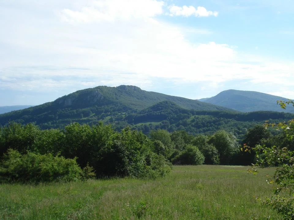
1. STARA PLANINA (OLD MOUNTAIN)
Why is Stara Planina a Top Hiking Destination?
It’s Serbia’s highest mountain (not counting Kosovo). Forests and meadows divided by mountain rivers and streams, and sprinkled with high cliffs, caves and waterfalls. This unspoilt beauty has it all.
Location: Eastern Serbia, part of Balkan Mountain Range
Highest peak: Midžor (2,169m /7,116ft)
Best routes: Waterfalls of Stara Planina and Normal Route to Midžor
Tell me more.
The most impressive part of Stara Planina are probably its powerful rivers that flow through their beds in red sandstone. Those rivers form many impressive waterfalls, highest in all of Serbia. This route follows the Toplodolska river, and passes all of its waterfalls, Piljski, Čunguljski, Kurtulski…The one day route is 23km long and it’s pretty easy. You will mostly be on the marked forest path, so don’t worry if you’re going in summer. At the end of the trek you’ll find the impressive Čunguljski waterfall where you can try and cool down, but beware – it can hurt!
Download the GPS trek
The hike up the highest peak in Serbia is sometimes described as the hardest climb in this country – the total elevation of 1440m in one breath! The hike itself is not technically difficult, but requires high level of fitness. You can choose to climb it in the summer or winter, and if you like hiking through the deep snow, be prepared you won’t be able to complete the climb in one day. It that case you can divide the route in two days and stay overnight in the Mountain House on Babin zub peak which you will also climb on this route.
The route starts in the village of Topli Do from where you start your climb on Midžor and then Babin zub (Grandma’s tooth). From there you descend through thick forests back to the start.
If this sounds too difficult for you, you can drive an SUV almost to the top (few km from the summit).
Download the GPS trek
Veliki Vranj Peak
2. HOMOLJE MOUNTAINS
Why is Homolje a Top Hiking Destination?
It’s a place of pristine wilderness. You can completely connect with the nature around you while you hike this mountain’s peaks.
Location: Eastern Serbia.
Highest peak: Štubej (940m /3084ft)
Best route: Homolje marathon
Tell me more.
On this trek of 28.5km, you will pass 4 highest peaks of Homolje Mountains: Štubej (940m), Veliki Vranj (884m), Vrata (815m) and Kobilja glava (778m). It's a circular route that starts at the 13th century Orthodox monastery of Vitovnica, in front of which you can easily park your car to wait for your return.
The route is visibly marked, but it wouldn't hurt to carry a GPS with this trek, or at least a map. It's of moderate difficulty, and the hardest, but also the most interesting part, is the climb on the Veliki Vranj peak. The climb is very steep and goes over a ridge so caution is necessary. Don't miss the Ceremošnja and Hajdučka caves which are located right off the path and marked.
Download the GPS trek
3. TARA MOUNTAIN
Why is Tara a Top Hiking Destination?
This pristine forested mountain, bordered by the river Drina, is probably the most beautiful mountain in Serbia. It offers a large number of marked trails including a section of the Via Dinarica long distance walk.
Location: Western Serbia, Internal Dinarides mountain range.
Highest peak: Kozji rid (Goat peak) (1591m/5220ft)
Best route: Zaovine triptych
Tell me more.
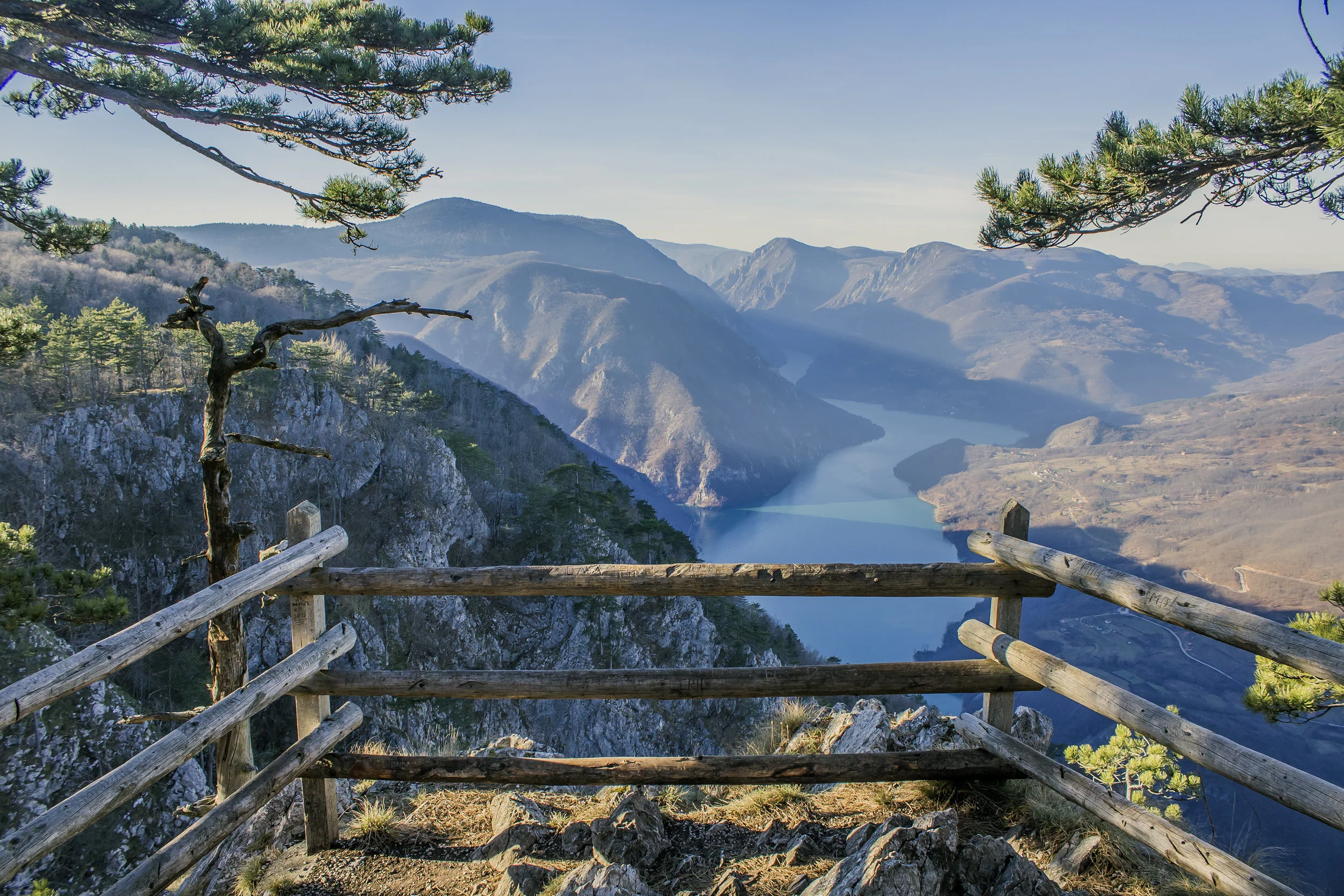
Tara National Park includes several peaks with deep gorges between them, the most impressive being the Drina Gorge, with cliffs of up to 1000m. It’s famous for the rare endemic Tertiary species, the Picea omorika, or Serbian Spruce, which is now protected in a small area of the park. Tara is also one of the last places in Serbia where you can find brown bears, and also many other different species of wildlife. Tara also has two beautiful artificial lakes – Perućac i Zaovine, popular for diving.
Zaovine lake is probably the best starting point for hiking on Tara because it’s located in its centre. This long and demanding hiking route, which was primarily designed as a cycling route, will take you to all the best part of Tara in just a few days. All three parts of this route start at Zaovine lake, where you can easily find accommodation in local cottages.
First part is the hardest and longest (80km). It will take you to over the mountain pass Krntija (1470m), under the Tara’s higest peak in Bosnia – Veliki Stolac (1673m), to Predov krst (1080m), where you can stay overnight in the mountain house. Next day you will go the Veliki Kraj viewpoint (or you can choose to go to the viewpoint Banjska Stena nearby), surrounded on three sides by the monumental Drina gorge. From there you descend back to Zaovine lake, passing the Perućac lake where you can treat yourself with a swim.
Second part of the route (53km) will take you to the peak Zborište and Mokra gora, a part of Mt. Zlatibor, and back to Zaovine. You can find accommodation in Mokra gora.
Third part is the easiest (48km), and goes across the beautiful forest and meadows of the eastern part of Tara.
Download the GPS trek

4. VRATNA GATES (PRERASTS OF VRATNA)
Why are Vratna Gates a Top Hiking Destination?
Vratna Gates are the Europe’s tallest stone gates. These impressive natural stone bridges were part of a big cave which collapsed a long time ago.
Location: Eastern Serbia.
Best route: Normal Route from the monastery
Tell me more.
There are three gates: called Little Prerast, Big Prerast and Dry Prerast. Mis-named, Little Prerast is actually the biggest, being 34m high, 33m wide and 15m long. The marked trail starts at the right side of the medieval monastery of Vratna through the forest. First two gates are just behind the monastery and the third one is 3km from them. You’ll follow the river Vratna, which you will have to cross in few places. On the way back you can climb on the second gate and enjoy the beautiful views.

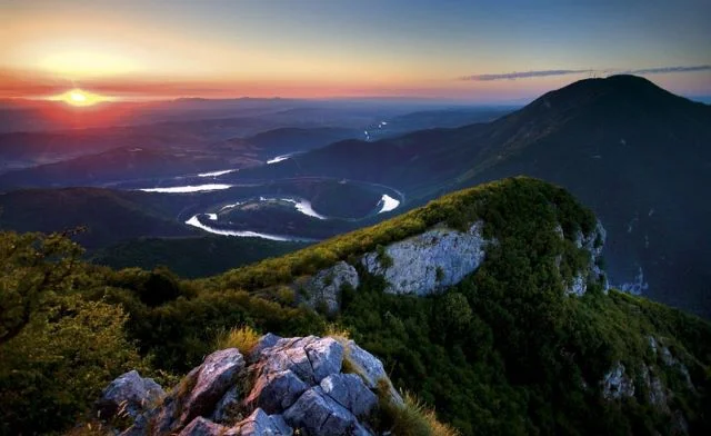
5. UVAC SPECIAL NATURE RESERVE
Uvac gorge is home to a large, legally protected population of griffon vultures. Seeing those magnificent creatures fly over the Uvac meanders is an unforgettable experience.
Location: Western Serbia.
Best route: Uvac meanders and Molitva peak
Tell me more.
The route is 15km long and it’s relatively easy. Climbing up to the the Molitva (Prayer) peak you will enjoy many viewpoints, and you will probably see a couple of griffons circling above. From one of the viewpoints you will have a good view of the Uvac Ice cave – which you can visit entering from the river on a boat (there are organized tours from the village on the shore).
Download the GPS trek

6. SVRLJIG MOUNTAINS
Why are Svrljig Mountains a Top Hiking Destination?
These amazing, unduly rarely visited mountains, offer truly pristine nature. You will be surrounded by the extraordinary views of the surrounding mountains and the impressive Sićevo gorge, by thick forests and grasslands, and followed wherever you go by the rosemary scent.
Location: Eastern Serbia.
Highest peak: Zeleni vrh (Green peak) (1334m/4377ft)
Best route: Niš traverse
Tell me more.
This backpacking, long-distance route is pretty difficult, and requires high level of fitness, but it will award you with its views and tranquility. On average, it will take you 5 days to finish the challenge, with daily walks of 20-30km. The whole trek is 143km long, with total elevation of 7150m. It’s circular and it will take you along the edge of the whole mountain. The route starts at the Niš fortress.
For detailed information about the route and the maps, contact Miloš Tašković at planinom@gmail.com.
Download the GPS trek

7. LAZAR’S CANYON
Why is Lazar’s Canyon a Top Hiking Destination?
The canyon is carved into the Kučaj Mountain by the Lazar's river, and it's the deepest and longest canyon in Eastern Serbia. It is an ideal place for any mountaineer – steep cliffs, wilderness and countless caves and pits make this place a must for any caver or a hiker looking for a true adventure.
Location: Eastern Serbia.
Best route: Lazar canyon
Tell me more.
The route starts at the Lazar’s cave – the longest cave in Serbia (9818m of passageways). First section of the cave is prepared for tourists so it’s a must-see. From there you descend into the river bed and just follow the river. It’s recommended that you go in autumn, when the river bed is dry (during the spring the river bed is full of water, and during summer you risk having an encounter with a snake!).
8. OVČAR & KABLAR
Why are Ovčar and Kablar Mountains a Top Hiking Destination?
River West Morava divides these two mountains creating amazing gooseneck meanders. This whole area is full of monasteries dating back to early 14th century, and for that is sometimes referred to as “Serbian Mount Athos” (Holy mountain).
Location: Central Serbia.
Highest peak: Ovčar (985m/3232ft), Kablar (889m/2917ft)
Best route: Ovčar and Kablar in one day
Tell me more.
This route is moderate, but with an average fitness level you can finish it in one day easily. In 20.8km it will take you to both peaks, passing by 3 monasteries. From both mountains you will enjoy the stunning view of the gorge and its meanders.
Download the GPS trek
9. FRUŠKA GORA
Why is Fruška Gora a Top Hiking Destination?
The only mountain in Vojvodina region used to be an island during the existence of the Pannonian sea, and it is built from rocks from almost all geological periods. These gentle hills are covered almost completely with thick forests full of life that will shade you from the summer sun. This whole region is famous for it's wine, so be sure to visit some of the local wineries for a refreshment after the hike.
Location: Vojvodina (Northern Serbia)
Best route: Fruška Gora Marathon
Tell me more.
Fruška gora is full ofmarked trails, and probably the best way to choose the desired difficulty of the hike, is to visit the website of the Annual Fruška Gora Marathon. Here you can read about all the routes, see the map and download the treks. You can choose from the easy short hikes of 3km, up to the two day Ultra-Extreme Marathon of 134.7km.

10. RTANJ MOUNTAIN
Why is Rtanj Mountain a Top Hiking Destination?
Rtanj Mountain is famous for its legends and mysteries. Because of its pyramidal shape, some believe that it’s actually a real pyramid, now covered with soil and forests. Others believe that this mountain is an alien base because of the many alleged UFO sightings. There is even one myth that a stargate and a timegate are situated at the top of the mountain! If you want to explore the verity of these myths, or just want to enjoy the 360° view from the top, Rtanj is definitely the place to go.
Location: Central Serbia.
Highest peak: Šiljak (Spike) (1656m/5433ft)
Best route: North face
Tell me more.
Climb to the top of Rtanj may sound like an easy hike, but it’s far from it. In the upper part of the route you won’t have any shade, so it’s recommended to hike it during the winter, or to start at night! This is a truly unique experience; start the route at midnight at Motel Rtanj, and sometime before sunrise you’ll be at the top, enjoying the 360° view of the surrounding sunbathed nature. Don’t forget a headlamp, a jacket and plenty of water. In the early morning, you will probably meet a number of people picking flowers - Rtanj is famous for its herbs, and Rtanj tea has numerous healing properties. Be sure to try it if you have a chance!
Download the GPS trek

LATEST BLOG POSTS
I quit the rat-race to live a more adventurous life. This is my journey.